The whirlwind tour of ABC in South America in 2019
Part 2 of 2
(Travel Story Series @ Hon Too Fang 2021)
Buenos Aires to Ushuaia
The local flight took about 3 hours.
Patagonia
Patagonia is a sparsely populated region at the southern end of South America, shared by Argentina and Chile. The total area is about 1.10 million sq km, 770,000 sq km in Argentina (about a quarter of the country) and 330,000 sq km in Chile (about half of the country). Total population is about 2 million, the majority in Argentina.
In terms of geography, the Argentina Patagonia is a region of steppe plains (treeless grassland), raising in altitude towards the west. At the Chilean side, vegetation becomes more luxuriant because of higher rainfall. Immediately east from the coast are the Andes, cut by deep fjords in the south and by deep lakes in the north. The high rainfall and low temperature contribute to the ice-fields and glaciers, the largest ice-fields in the Southern Hemisphere outside of Antarctica. Overall it is dry and cool.
The principal economic activities here are mining, whaling, livestock (mostly sheep), agriculture (wheat and fruits near the Andes towards the north) and oil. Tourism started in the 2nd half of the 20th century.
Ushuaia
Ushuaia, population 60,000, is reputed as the southern-most city in the World. It was cold and windy, around 5 to 6 degrees most of the day, in late summer or early autumn. Shown street scenes, with the buildings against the backdrop of snow-capped mountains. Many shops are selling cold weather wear and outdoor gear.
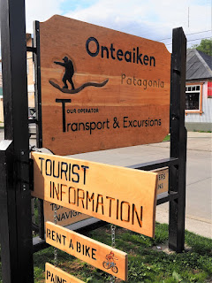
It is a port of call for cruise ships, big and small, including those to the Southern Antarctica. It is also the gateway to the popular Tierra del Diego National Park. Small tour agency booths line the waterfront.
On food, the southern king crab (lithodes santolla) is a must try in Ushuaia. This one cost about RM 175. In KL it could cost more than double. The other dish is fried prawn and squid. Certainly enough for 2 people. Had this at the famous Restaurant El Viejo Marino.
We visited Museo del Fin del Mundo, a museum on natural history of Ushuaia and southern Patagonia. Shown specimens of penguin and owl. The last photo is a shot of the poster of some sea creatures.
Tierra del Fuego National Park
This is the southern-most national park in Argentina, established in 1960. The first shoreline national park too. The name means “land of fire” named when the first Europeans saw the campfires of the natives here. The park has dramatic scenery with mountains, valleys, lakes, waterfalls, glaciers, etc. The area is 630 sq km.
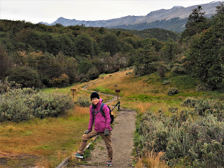
Many trekking options are available. We chose an easy one, 5+ km, taking about 3 hours. Other members were mostly on more difficult or longer treks. Shown typical scenes.
The Flora: shown 2 plants here, the 1st one is volutaria bollei, a kind of sunflower, native to Patagonia. Then 2 semi parasitic plants, the green/yellow one is misodendrum punctulatum, also native to Patagonia.
The Fauna: a beautiful male Magellan goose and a male Homo sapiens from Rio, Brazil who has ridden 8,000 km to come here.
Ushuaia to El Calafate to El Chalten
We flew from Ushuaia to El Calafate, 1+ hour with Aerolineas Argentinas, another unfamiliar name to us.
We took a bus from El Calafate to go to El Chalten, 220 km away. Shown scenes along the journey, mostly uninhabited regions. The last 2 photos were taken at a rest area on the 2-lane highway.
El Chalten
El Chalten is a small mountain village, altitude 400 m and population 400 to 1,600, depending on season. In the local native language, it means “smoky mountain”. Lonely Planet in 2015 named it 2nd in the list of “Best Cities in the World to Know”.
Tourists seem to double every other year, attracted by the glaciers, mountain climbing and most of all trekking. It is marketed as the Trekking Capital of Argentina. The place has a sub-polar oceanic climate, cold even in spring and autumn. Always windy too.
Shown at the main town square. The mountain in the back ground is Mt Fitz Roy, with the highest peak at 3, 405 m.
Buildings are mostly hostels. We had a very good roast lamb meal here.
Surprise of the tour
And the Surprise of the Tour. Met a university classmate here. He is MP who has authored 5 or 6 travel books in Chinese. He was in a 6-people family group. We last met probably 2 years ago in a classmate gathering in KL. El Chalten is on the other side of our globe, and needs at least 50 hours of flying and transit time from Kuala Lumpur. Yet we could meet each other here. Has to be a big surprise.
Trekking day
There are many established treks. One could choose any trek or treks, depending on one’s ability or preference. The more difficult and longer treks lead to the base of either the peak of Cerro Fitz Roy or Cerro Torre or to the highland lake of Laguna Capri. Our fitter and younger members went for those which were over 20 km. In fact a few trekked around 40 km. We were the oldest in the group and we opted for some easy treks.
Cerro Fitz Roy trek
We started with the Cerro Fitz Roy trek but returned after the Vueltas viewpoint, about 2.5 km from the starting point of the trek and 3.5 km from our hostel. So a total of about 7 km.
The last 2 photos show the Vueltas River and basin. This Vueltas Viewing Point offers fantastic vista. We made a return to our hostel after this.
Laguna Torre trek
This is a trek that ends at Lake Torre, 9 km from the starting point which is about 1.0 km from our hostel. I went up alone in the afternoon. Shown the scenes of the meadow overlooking the town before the official staring point.
Scenes at the beginning of the trek. The last photo shows the 1st viewing point called the Margarita Viewpoint.
Now the later part of the journey, more of the same terrain. At the Torre Viewpoint one could have a clear view of the snow-capped peaks in the Torre group. This was about 2.5 km from the starting point. I trekked may be another half a km more and called it a day. The total distance trekked is about 7 km too from the hostel, same as the morning trek.
El Calafate
El Calafate is a city in the Argentinian Patagonia near to the Chilean border. It is a fast growing tourist town. The 2014 estimated population is 20,000. Shown a few street scenes.
Perito Moreno Glacier
The Los Glaciares National Park in southern Argentina is the largest national park in the country and a UNESCO World Heritage site. Within this park is the Southern Patagonia Ice Field. The ice field is the 3rd largest in the World, after the North and South Pole fields. There are 48 big glaciers in the ice field. One of them is Perito Morena Glacier, about 80 km from El Calafate.
We had a half-day tour of this Perito Morena Glacier, walking on metal decks to admire the glacier from a distance. The 1st 2 photos show the general view, 3rd a close up. Check out the size of the people in the foreground of the 2nd photo to realise the size of the glacier. The width of the terminus is 5 km, an average height of 74 m, and a frontal height of 60 m, like a 20-storey building. Just look small in the photo.
Shown a view of Lake Argentino where the glacier feeds and 2 plants native to Patagonia: the Chilean firebush with red flowers and the lenga tree, with the leaves turning fellow to welcome autumn.
We were supposed to take a boat ride to get near to the glacier. However the only cruise boat was out of service. Another possible activity here is canoeing, but only for the more adventurous ang moh. The canoes are waiting for us.
El Calafate to Puerto Natales
From El Calafate in Argentina we took a 6-hour bus ride to Puerto Natales in Chile.
Chile
Chile, officially the Republic of Chile is a country occupying a long narrow strip of land between the Andes and the Pacific Ocean in South America. The area is 756,000 sq km or 2.3 times that of Malaysia. The national language is Spanish and the capital and largest city is Santiago.
The Spanish first came here in 1920 and soon the region was colonised, in stages. Independence was declared in 1818 and fully recognised in 1844. Current culture is heavily influenced by the Spanish. The most popular sports is also football. It hosted the 1962 FIFA World Cup Finals when it finished 3rd, the highest position it ever achieved.
The population is 18 million with 63% whites, 30% Mestizo (mixed blood) and 6% indigenous. On religion, 55% Catholics, 13% Protestants and 25% no religion.
Chile has a high-income economy. It has the highest degree of economic freedom in South America and 7th Worldwide. Mining, mainly copper, contributes to 15% of GDP and 50% of exports. Agriculture 4%. Chile is the 2nd largest producer of salmon the World. Manufacturing contributes 13% and services near 60%. Tourism is growing steadily.
Puerto Natales
Puerto Natales is a coastal town in the Chilean Patagonia, population about 17,000. It was established in 1911 as a port to support the sheep industry. The sheep industry has declined but a new industry, tourism, has picked up steam. It is a gateway to the popular Torres del Paine National Park as well as the terminal for cruise boats touring the Patagonia fjords.
Shown street scenes. The 2nd photo was taken at the main town square with the Church of Our Lady Help of Christians in the background. The 5th photo shows a figure of mylodon, an extinct giant ground sloth found in the Mylodon Cave nearby.
Church of Our Lady Help of Christians
The church was founded in 1918 and the present building completed in 1930, with a clock tower some 25 m high complete with a German electromechanical clock. We attended a 7.00 pm Saturday evening mass here.
Coastal promenade walk
The water front is about 3 km long and we walked a big part of it. Shown the historic pier with the wooden poles used to support the docks and a modern sculpture called Monument of the Wind at the Indigo Pier created in 2012. We had to leave early when threatening storm clouds were forming.
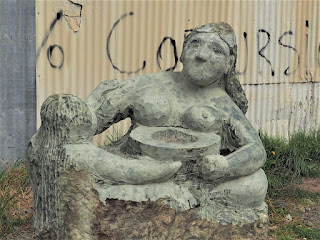
Shown some monuments. The Monument of the Hand with 5 fingers emerging from the ground, erected in 1993. A statue of the Italian scientist/explorer Alberto de Agostini (1885-1960) and an identified sculpture. A colourfully painted shop for the needs of back-packers.
Torres del Paine National Park
The Torres del Paine National Park is located in the southern Chilean Patagonia encompassing mountains, glaciers, lakes and rivers. “Paine” means blue in the local language. The park was established in 1959 as Grey Lake National Tourism Park and was given its present name in 1970. It was designated a World Biosphere Reserve by UNESCO in 1978. The park is about 1,800 sq km in size, one of the largest in Chile. The park entrance is about 110 km north of Puerta Natales.
Shown scenes of the journey from Puerta Natales to the national park. The last 2 photos show wall decoration of a shop at a highway stop.
Around the lake areas
This is a huge park. This series of photos were taken around the lakes area. First the vast Chilean steppes, treeless. The animals shown are guanaco, a camelid native to South America, closely related to the llama.
There are many lakes, Lake Nordenskjold being the key one. Great vista everywhere.
And the peaks. The 3 main ones are known as Torres d'Agostini, Torres Central and Torres Monzino. They are some 2,500 m above sea level.
And fauna: the Rufous-tailed hawk on the tree and the caracara on the ground. The caracara is a bird in the falcon family which prefers walking over flying.
Lake Grey area
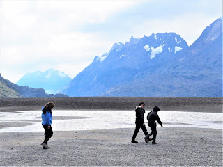
From the parking area we had to walk on a suspension bridge to cross a river and a forested area to reach the beach of Lake Grey. Walking on the beach was difficult as it was very very very windy. We could say that we have not experienced such strong wind before in any other places. It seems it is always windy here, may be some kind of wind tunnel effect. Icebergs from the Grey Glacier could be seen in the lake, last photo. We didn’t walk to the point where we could see the glacier. Simply too windy to be comfortable.
Punta Arenas to Santiago
From Puerta Natales we took a bus to Punta Arenas to take another local flight to Santiago, about 3 hours flying time. Sky Airline, another unfamiliar name to us.
Santiago
Santiago is the capital and largest city of Chile as well as the cultural and financial centre. The metro population is 6.3 million. The city is located at the centre of the Santiago basin, fertile land surrounded by mountains. It was founded by the Spanish in 1541 and named after St James. It has been the capital since colonial times.
Plaza de Armas is the main square in the city, big and friendly, established in the 1540s. Shown scenes at the square. The statue in the 2nd photo is that of Pedro de Valdivia, the Spanish conquistador who founded Santiago and became the first governor of Chile. Last 2 photos show people playing chess and stalls of fortune tellers.
Santiago Metropolitan Cathedral
Construction of the cathedral began in 1748 and it was completed in 1800 in neoclassical style. Previous versions of the cathedral was destroyed in earthquakes. The cathedral has dominated the Plaza de Armas or Main Square ever since. The decoration is mostly in Baroque style. It has a richly decorated altar. The last photo is the Chapel of San Michael the Archangel.
Santa Lucia Hill
Santa Lucia Hill is a low hill in the city centre. It is a park adorned with ornate facades, stairways and fountains. The building featured is called Neptune Terrace.
Valparaiso
This is a major city and port, 120 km north-west of Santiago. The city population is 280,000. It was a major international port before the opening of the Panama Canal in 1914. It has since become a university town and a tourist attraction, the historic city centre becoming a UNESCO World Heritage site in 2003. The selling point is street art and the classic funicular cars. Valparaiso is marketed as the Graffiti Capital of South America.
Plaza Sotomayor
This is one of the main squares. Shown the Intendencia Building (equivalent to the City Hall Building) designed in French Renaissance Revival style, and the monument to honour Chilean sailors who fell during certain wars.
Funicular railway
Funicular railways were built to provide transportation service between the city centre and the lower slopes of the hills. At the peak there were 28 such railways. About 10 are in service during our visit. We tried that of course. Shown a line and a coach on the move.
Street Scene
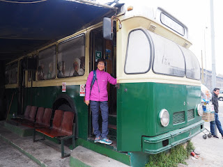
The city runs a tram system and there is even a stationary coach at the terminal for tourists to take photo.
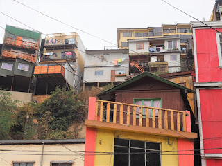
Some strange buildings and some building decorations.
Graffiti Capital of South America
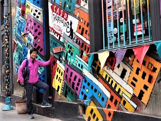
Valparaiso is built over a cluster of hills overlooking the ocean, characterised by brightly coloured buildings and interesting wall murals or graffiti.
A bit of history on the wall mural culture. In the 1940s a Chilean diplomat Pablo Neruda returned to Valparaiso after his posting in Mexico City. The wall mural art was blooming in Mexico City. So Pablo Neruda invited artists from Mexico to come to Valparaiso and kicked off the wall mural culture. Incidentally Pablo Neruda was also a poet and won the Nobel Prize for Literature in 1971. But the art here really started to bloom in the 1970s when people started to paint political messages on the wall to protest the rule of the dictator General Pinochet. They were illegal then. After the downfall of the Pinochet regime and the return of democracy in Chile in the 1990s, Valparaíso’s local government made street art legal in a move to celebrate freedom of expression.
The first one is political, the next was painted by the local artist Cuellimangui who had a liking for sea worms. The last two are typical expressions of a couple painted by a husband-n-wife team collectively known as Un Kolor Distinto.
The old lady in the 1st photo appeared in several locations.
Tour ended
The whirlwind tour is completed and the story ended. On the flight back we had a long transit stop in Amsterdam, the Netherlands. So we went to Kuekenhof to watch the famous tulip show. But that is another story.
Footnote
The tour in fact totals 20 days, a few days lost in the long flights and transits.
There are 20 of us, mostly seniors. The tour operator is YonGo Travel (www.yongo.biz). Thanks to Rachel our tour leader and fellow travellers for a great tour. And thanks to the readers for your company in this virtual tour. Hope you too enjoy the tour like we.
To some of us the tour was really a bit too short. 3 weeks for 3 big countries. Another 2 weeks would be welcome so that we could cover a few more places in Brazil and Argentina. But to the tour operator more weeks means less people could afford the tour in terms of money or in terms of time. To them 3 weeks is the best schedule.
A group photo taken at the Graffiti Capital of South America.
(First written and posted as daily WhatsApp messages during the tour in March 2019. Heavily revised to this PDF format in September 2021)
















No comments:
Post a Comment