Suffer acute mountain sickness in Tibet in 2010 - Part 2/2
(Travel Story Series @ Hon Too Fang 2021)
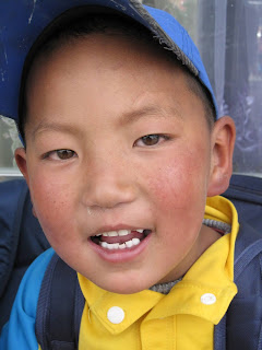
Faces of children
Some faces of young students in the city, looking healthy and smart.
4. 6 - Shigatse to Tingri
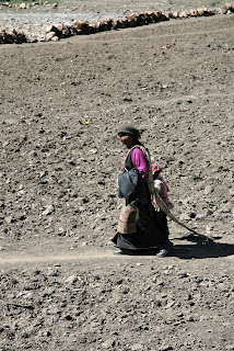
Our next destination is the small town of Tingri 定日, 240 km south-west by road distance. Scenes along the journey, with a stop at a village. Simple houses with dung cakes (for fuel) being dried on the roof. Tough living conditions throughout.
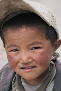
Faces of children
Faces at the village: also looking heathy and smart.
4.7 - Sakya Monastery
About two-third along the road from Shigatse to Tingri is located this famous Sakya Monastery 萨迦寺. It is the main monastery of the Sakya order, one of the 4 main sects of Tibetan Buddhism. In fact Sakya was the oldest sect. There are over 150 Sakya monasteries all over China and neighbouring Nepal and India, with over 10,000 monks of the order.
There are actually 2 separate Sakya Monasteries in this location, on either side of a river. We visited the southern one founded in 1268. The northern one is older. The monastery was built as a kind of fortress, with thick defence perimeter walls and defence towers. The main building is the Great Scripture Hall 大经堂, 66 m wide, 23 m deep, 1st photo.
This monastery is actually famous for its library of old manuscripts and old tangka drawings. Ordinary tourists like us won’t find them interesting though. Shown some doors and decorations, and monks watching us.
4.8 - Mt Qomolangma tourist base camp
From Tingri we travelled about 110 km (about 80% on unpaved mountain road) to the Mt Qomolangma tourist base camp, elevation 5,220 m. The “western” name for Mt Qomolangma, the highest peak in the World, is of course Mt Everest.
Scenery along the journey. The 2nd photo was taken at a pass at 5,290 m elevation, with locals selling Tibetan souvenirs. The distant peaks in the photo include Mt Everest. The 3rd shows the winding road. The 110 km journey took more than 4 hours.
(Note in 2021: The road from Tingri to the base camp has since been improved. It was fully paved by 2015 with better alignment in certain parts. Travel time is now about 3 hours.)
Mount Everest is the main peak of the Himalayas and the highest in the world, with a height of 8,848 m. It is located on the border between China and Nepal. The tourist base camp consists of simple tent accommodations for tourists. It is at 5,200 m height. The best point to see Mount Everest is atop a “mole” hill may be 15 m in height. And a lot of effort was needed to climb this 15 m due to the low oxygen level at this height. Everybody was panting. The small dots in the foreground of the last photo are the tents at the real Base Camp for climbers. Please do not confuse the Base Camp here with that in Nepal.

We were extremely lucky to have the full view of the peak which is about 20 km away on a straight-line distance. According to the locals, such clear vista is possible only once in 3 or 4 days. At other times it is either obstructed by clouds or unclear due to mist. We had to thank our lucky star, or our god.
But not all of us are that lucky. One male group member collapsed after stepping out of the eco-friendly bus at the base camp. A severe case of High Altitude Sickness. He was helped back to the bus and given oxygen. It could be fatal. The best cure is to go down to a lower level immediately. So the tour leader gave us only 15 to 20 minutes of photo time and after that we immediately went down, foregoing our lunch at the base camp and the visit to the highest Tibetan temple in the World. We had our lunch some 3 hours later at a town called Tashi Dzom, 4,145 m in elevation.
Journey from tourist base camp back to Tingri
Showing more of the harsh living conditions. The last 2 photos show the street scene of the town of Tashi Dzom 扎西宗where we had lunch.
We stayed a night at the no-star hotel in Tingri, elevation 4,300 m. The next day we went back to Shigatse, met some goats or black sheep?
4.9 – Namtso
From Shigatse we travelled north-east for 250 km to reach Namtso, the “Heavenly Lake”. Scenes along the journey. All barren landscape; saw a train on the famed Qingzang line.
Namtso 纳木错is 4,718 m above sea level and covers an area of 1,870 sq km, larger than our Malacca state. It is a salt water lake and the 2nd largest lake on the Qinghai-Tibet Plateau. It is so big that it has “tidal” waves. Clear blue sky and clean turquoise water. So transcendent, so heavenly. No wonder the Tibetan calls it “Heavenly Lake”. Namtso is one of the 3 large sacred lakes in Tibetan Buddhism, with the shoreline well decorated with prayer stones, prayer wheels, prayer flags, etc. The decoratively “attired” yak is a top model for photo shoot, 5 Yuan for multiple shots.
The two blocks of sacred rock are called “Welcoming Rock 迎宾石” to greet visitors. The 3rd photo shows a row of stalls, but none was open. We were here in mid-May, already in late spring, but considered only as the beginning of the tourist season. Winter and early spring is too cold for visitors. The restaurants and guest houses are clustered at the foot of a cliff to shelter from the strong winds.
The accommodation is most basic, with women sleeping in the bedrooms and men on the couch in the hall. I had never seen so many stars in the sky before, outside the guest house of course. So clear the sky. Unpolluted. But sleeping was a problem for me. It was an unforgettable night: air freezing, no wife to hug for warmth. Then wild dogs howling outside, strong wind pounding the doors and the walls, and hall-mates snoring. Quite an unusual symphony being played out. I stayed awake way past mid-night.
5 – Qingzang (Qinghai-Tibet) Railway
For this trip we flew from Chengdu to Lhasa, for the return we took the train for a different experience. The initial section is the highly-hyped Qingzang Railway 青藏铁路from Lhasa to Xining 西宁市, 1956 km long and newly completed in 2006. Total journey to Chengdu is about 3,200 km and it took some 45 hours. We in fact spent 2 nights on the train.
(Note in 2021: this Qingzang line is not the high-speed train we normal associate with Chinese railways. This line caters for the slow trains, between 100 to 120 km/h.)
Construction of the Qinghai-Tibet Railway might be an engineering marvel due to the difficult ground conditions, from the viewpoint of a passenger on the train the journey was very monotonous and is over-hyped. We have 4 soft sleeping berths to a cabin. For my cabin all men. 2 nights. May be if they put two girls and 2 men here it should be more interesting!
Typical scenery along the journey, mostly barren landscape 吋草不生and monotonous. The 1st photo shows new the train station at Lhasa.
6 – Chengdu
We had one and a half day in Chengdu, a city in Sichuan with 12 million people. Tour details will not be covered here. Just a few photos - at the Panda Research Base to see some fellow with 2 black eyes, enjoy fellowship and tea at the garden of the Wenshu Monastery文殊院, buy souvenirs at Jinli Street 锦里古街, find solace (went alone) at the Catholic Cathedral located at Peace Alley 平安桥天主教主座堂, get your tongue numbed with extremely spicy and hot “mala steamboat”with Bro Looi and Bro Liu , and sharing the joy with a loving father.
(Note in 2021: Bro Liu is one of the most travelled people I ever met. He has been to over 107 countries including places like Faroe Islands, French Polynesia, Tonga, Madagascar, Namibia, Vanuatu, Antarctica, etc. Nowadays he travels solo.)
7 - The Acute Mountain Sickness
This is the question bothering everybody intending to go to Tibet. Most of the Tibetan Plateau is above 3,000 m, with the capital Lhasa at 3,490 m. This acute mountain sickness could be loosely defined as the discomfort one experiences when one “suddenly” goes to a place more than 2,500 m in elevation. The discomfort could be in many forms: shortness of breath, headache, nausea, loss of appetite, trouble sleeping, etc. It could progress to a more severe form and the most severe case results in death.
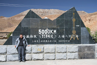
So how high were we? The Mt Everest base camp was around 5,200 m. During the journey we passed through many spots over 5,000 m. Here are some milestones or meter-stones. The last photo is not about height, but about distance. The G318 is an old national highway with the starting point from the People’s Square in Shanghai and ending at a town in the Shigatse Prefecture, totalling 5,476 km, the longest of the national highways. This marker shows that the location is 5,000 km from the starting point in Shanghai.
The oxygen content in the air is reduced by 40% when one reaches a level of about 3,600 m. Shortness of breath is obvious when there is any physical exertion. To me the problem is really at night when I am on the bed. During the day when we are physically active our brains would tell our lungs to breathe faster since more oxygen is needed. But when we lie down to sleep the brain’s signal to the lungs is that they can relax now and don’t need to breathe that fast since there is no physical exertion. But because of the lower oxygen content in the air, we are certainly not getting enough oxygen. We consciously try to breathe faster and so we can’t relax enough to go to sleep.
This mountain sickness is truly a democratic fellow. He attacks his victims irrespective of race, gender, age or even fitness. We have fit young members vomiting the second day we were in Lhasa. Then we have my room-mate, in his 50s, not affected at all. He sleeps at 10 every night. Yes, my roommate is a man. My wife did not go on this trip. Not sure why, might be in the middle of the 18th Cold War. Another member, in his 50s, literally collapsed at the Mt Everest tourist base camp. He was put on oxygen. We had to cut short our sight-seeing there and came down to a lower elevation as this is the best cure for the illness. He fully recovered by the evening.
8 – Reflection
Salute the Tibetans
Most parts of the Tibetan Plateau we came across were barren ground. Living conditions were very harsh. Cold and windy. There is so little rainfall that there is little land suitable for farming. Even grassland is extremely rare. Many Tibetans are forced to become nomads. We have to salute the Tibetans. Shown a settlement near Tingri. How to stay here?
(Note in 2021: China declared in 2020 that everybody in the Tibet region is lifted out of extreme poverty despite the harsh weather and living conditions. The government has initiated a lot of initiatives. One of them is the private east-west initiative where corporations in the rich eastern provinces help the poorer western provinces and regions. Over a thousand such projects have been implemented in Tibet. At the same time, government initiated detailed studies of the conditions of each county to propose specific viable economic projects. In general infrastructures were expanded, vocational training promoted for the younger members of the nomads and farmers to find alternative employment, promoting tourism, and the most effective of all, the relocation of over 260,000 people from “impossible” villages to more “liveable” new places. Tourist arrivals continue to expand exponentially and coupled with e-commerce, the demand of Tibetan handicraft will lift tens of thousands of Tibetan households to the middle income groups.
I am sure it is a very different Tibet we will be seeing if we go now, 11 years later)
Photo of the Trip
He is hitch hiking, to get away. Even an ass can't take the harsh living condition.
Promoter of the Tour
This tour was marketed by YonGo Travel: http://www.yongo.biz
Is the trip worth it?
A few friends asked me if the trip was worth it vis-à-vis the sights we saw, the adventure we experienced, against the suffering (high altitude sickness) we had, and the time and money we spent.
I have no answer as what is worthy or what is not is such a relative term. Just like rich and poor are relative, but I do know the rich has more relatives.
I like to quote what our tour mate Gloria said to end this account, “despite the suffering, we have enjoyed so much on this trip, and the fellowship.”
The end. Thanks for reading to the end.
(First written in August 2010. Heavily revised to this PDF format in July 2021)


No comments:
Post a Comment