To find Shangri-la in Sichuan, China in 2015
(Travel Story Series @ Hon Too Fang 2021)
My friends, in October 2015 the 2 of us, together with old friends KS and CL, joined a small group tour to the north-west and western parts of Sichuan, China. Hoping to find our Shangri La. A scenic journey with a touch of Tibetan culture. I ran out of jokes after my recent Ethiopian travel story. So no jokes here but a straight forward travelogue. Will present more photos of scenic spots.
First a few words about the region.
Sichuan (四川)
This is a big province in central south-west China, about 1.5 times bigger than Malaysia, with a population of 81 million. Administratively it has 21 prefectures and over 5000 townships. The capital is Chengdu.
Our tour is a road trip starting from Chengdu, going north-west through the Aba Prefecture, swinging further west through the Garze Prefecture and then south to end at the district and townships of Daocheng and Yading, still in the Garze Prefecture. Took a local flight back to Chengdu.


The Prefectures
Both the Aba Tibetan and Qiang Autonomous Prefecture (阿坝藏族羌族自治州) and the Garze Tibetan Autonomous Prefecture (甘孜藏族自治州) are dominated by ethnic Tibetans. For example, in the Garze Prefecture, population 900,000, 78% are Tibetans, and 18% Hans.
Readers shouldn’t find this Aba Prefecture unfamiliar. One of the most popular tourist destinations in China for Malaysians is Jiuzhaigou (九寨沟), and it is located in the same Ada Prefecture, but further east.
The Plateau
The city centre of Chengdu is around 500 m above sea level. Our first overnight stop out of Chengdu is Siguniangshan Town (四姑娘山镇), elevation near 2,900 m. For the remainder of the trip the ground was mostly above 3,000 m. This region is part of the Qinghai-Tibet Plateau (青藏高原).
Now we start our journey to find Shangri-La. 7 of us in two 4 by 4.
A1: Chengdu to Siguniangshan Town (四姑娘山镇)
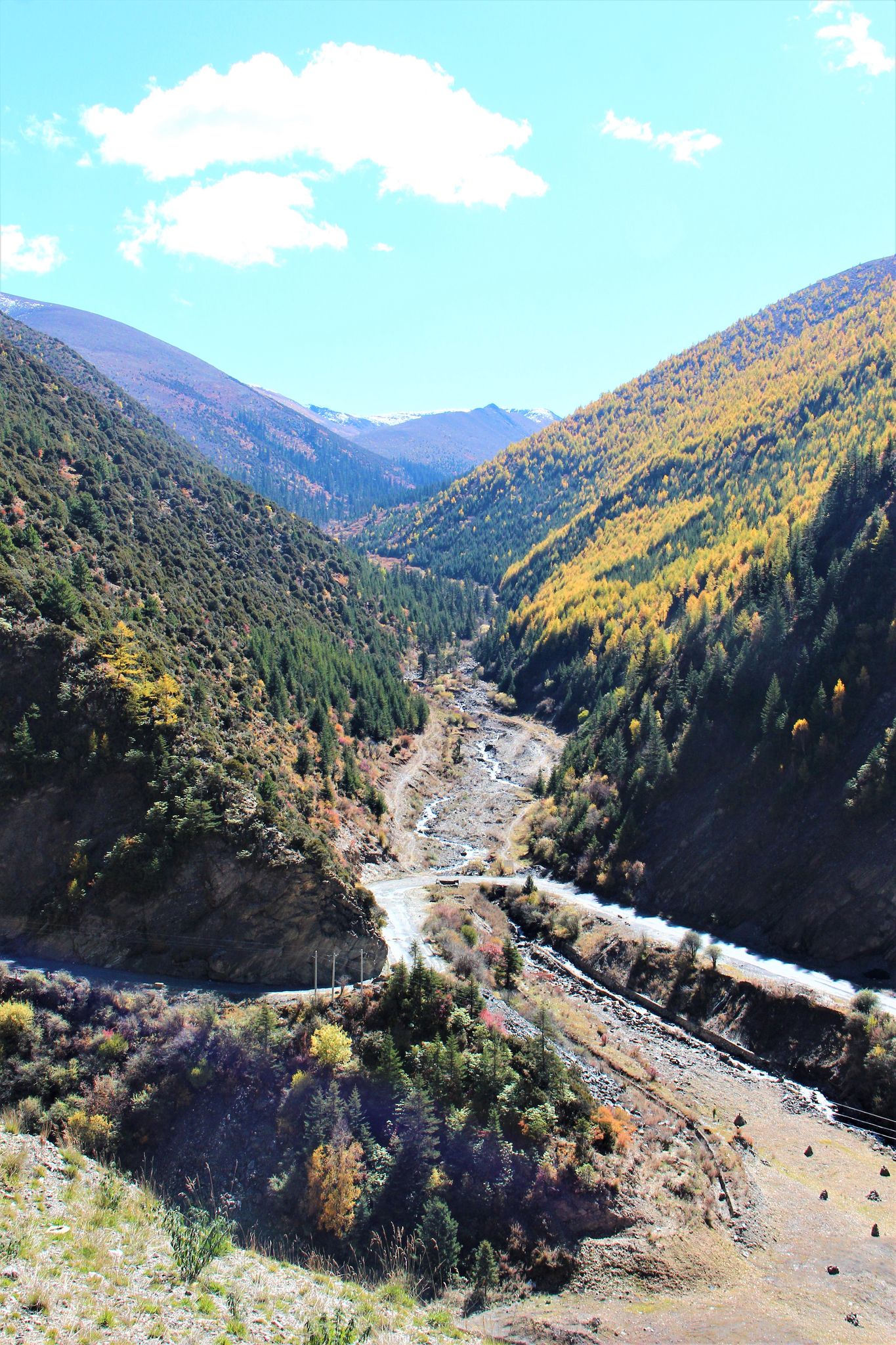
The distance is only about 220 km but it took us some 6 or 7 hours. Wasted more than an hour to get out of the traffic jam within Chengdu city, then spent 2+ hours for a short stretch within the Wolong Nature Reserve (卧龙自然保护区) where the trunk road was badly damaged in the 2008 Wenchuan (汶川) earthquake and was still under half-hearted repair. Heard that they are constructing a new road to replace the old one, hence not really repairing it to the required standard. The route included the pass at Balangshan
(巴郎山垭口) which is near 4,500 m in height. Shown pleasing scenery at Balangshan Pass and the sickening condition of the road.


(Note in 2021: a new road connecting Siguniangshan Town and Chengdu has been completed and open to traffic in late 2016. Not an expressway but an improved state road where some parts of the old roads are retained, alignments straightened and many bridges and tunnels incorporated, reducing the distance from 220 km to 175 km and the travelling time to 3+ hours.)
A2: Siguniangshan Town (四姑娘山镇)
This is the gateway to the scenic Siguniangshan National Park. A small town previously (pre-2014) known as Rilong (日隆). We stayed at the new area known as Changping
(长坪). The buildings are less than 2 years old, in Tibetan style of decoration. The 1st one is our hotel, Kelsang Metok 格桑梅朵 which is the name of a flower.


A3: Siguniangshan National Park (四姑娘山国家公园)
It is a giant park, some 1,380 sq m in size. It is a UNESCO World Heritage Site, being part of the Sichuan Giant Panda Sanctuaries. As a tourist attraction, the selling point is a mountain range and 3 valleys. The mountain range is of course Siguniangshan
(四姑娘山) which has 4 famous peaks, ranging from 5,355 to 6,250 m in height. The 3 valleys are Changping Valley (长坪沟), Haizi Valley (海子沟) and Shuangqiao Valley (双桥沟).
A4: Shuangqiao Valley (双桥沟)
We had a full-day tour in this valley, 35 km long, 220 sq km in size. We had to take the special electric bus to go in. The bus would stop at 5 intermediate stations. The Valley has some 20+ scenic spots, typical in China, stressing to sell quantity. Shown with CL at the entrance which itself is part of a gorge.


We took the bus to the last and highest station and later moved downwards. The last station is 3,840 m in height. Many snow-capped peaks, none we know the name. And glaciers too. We were told none of the 4 famous peaks of Siguniangshan could be seen in this Shuangqiao Valley.


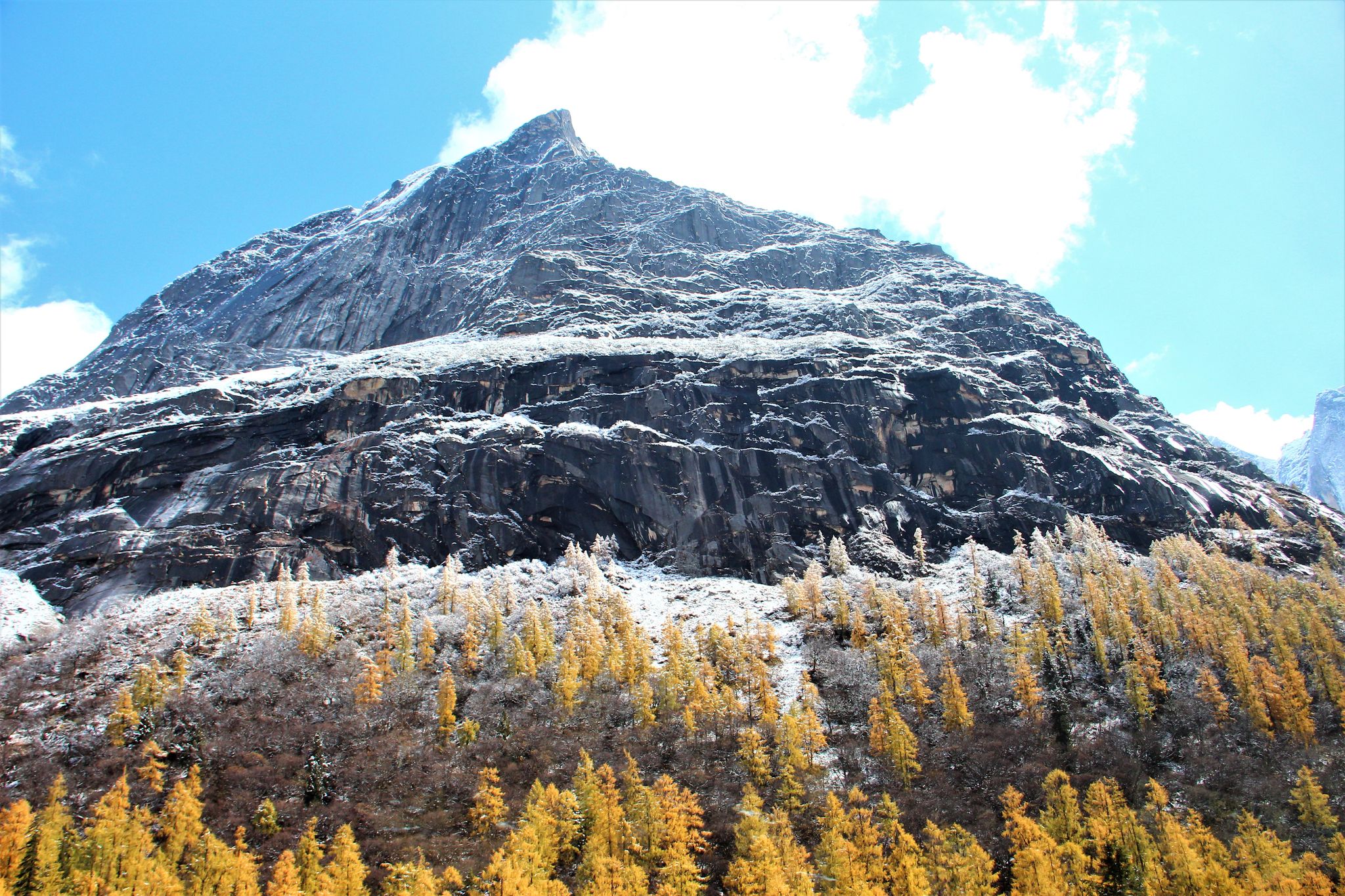

One scenic spot is named Hongshanlin (红杉林) which is a forest of Chinese Redwood. The Chinese species called Metasequoia is much smaller than the Californian Sequoia. We did not encounter “fresh” snow but the place must have snowed not long ago.


Pasture at the middle stations as well as the reminder of Tibetan culture with stupas, prayer flags and mani stones.


At the lower station, one of the scenic spots is named “Penjingtan” (盆景滩), literally meaning “the bonsai beach”. Dead trees, some calcified, dot the shadow sandy stream, creating a bonsai scene. The sandbar is another scenic spot, named “Zhenzhutan” (珍珠滩) or literally the “pearl beach”. Under the sun, the flowing stream is like a sheet of jumping pearls. See the pearls? And a group photo with old friends KS and CL.


Diversion - We are now entering the Garze Prefecture. I would now go off-course to enlighten my readers a little bit about Tibetan culture. These diversions come under the B series.
B1: Khampa culture (康巴文化)
Historically and based on the dialects spoken there are 3 main Tibetan regions in China:
U-Tsang, Kham and Amdo. U-Tsang is the Tibet proper based in Lhasa. Kham consists of the eastern Tibet Autonomous Region (西藏自治区), western Sichuan province and north-west Yunnan province (云南). Amdo is in Qinghai province (青海). The people in Kham is called Khampa and the Khampa culture incorporates many elements of Han culture from the Huanghe (黄河) and Changjiang (长江) civilisation as well as the culture of many minority tribes from the Yunnan region. It has a broader and more encompassing colourful culture than the main Tibetan culture based in Lhasa.
The Garze Prefecture is the centre of the Khampa culture.
A5: Danba (丹巴)
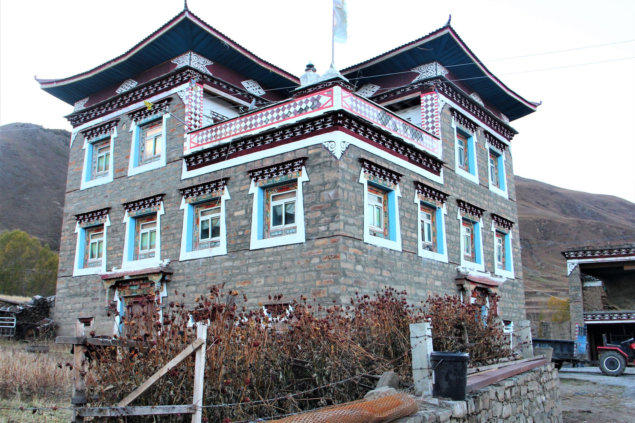
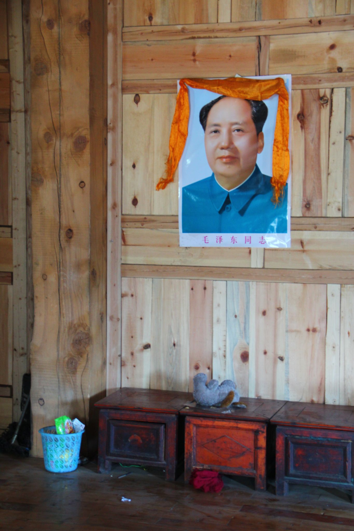
Our next stop is Danba, a town on the eastern border of the Garze Prefecture and 110 km west of Siguniangshan Town. We had a home-stay in a big Tibetan house. Maize everywhere on the flat roof, and their god is Old Mao. It is a fact the communist government liberated the ordinary Tibetans from the old feudal rule by the clergy under which ordinary people were semi slaves.


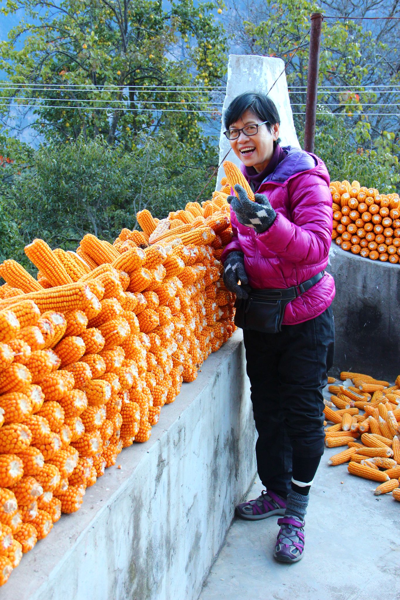

Danba, population 60,000, is in fact famous for 2 things: beautiful girls and beautiful valleys/houses. The first claim is difficult to prove. I couldn’t investigate further as my wife was with me all the time! But the 2nd claim looks true. There are several villages on our route famous for their big houses. QED. One of them is Jiaju Village (甲居). The yellow things on the roof in the 2nd photo are maize. Lots of the amazing maize.


A6: Danba to Xinduqiao (新都桥)
Xinduqiao is about 150 km south-west of Danba. Dotting the mountains in the early part of the route are old defence watchtowers. More than 80 of them, about several hundred years to a thousand year old. Shown one viewed from a distance. Midway along the journey saw a strange group of rock outcrops called Bamei Shilin (八美石林) or the Stone Forest of Bamei. The rock type is mylonite (糜棱岩). The rocks are about 2 to 3 km away from our viewing point, shot with a tele zoom lens. Look unreal.


We also passed through the Tagong Grassland (塔公草原), elevation around 3,730 m, a famous patch of highland pasture.


And a few scenic shots. Season-wise it is already late autumn, but autumn foliage is still not very prominent in this part of the province. Our drivers: the senior one Luorong and the junior Wandui, an uncle-nephew tag team.


A7: Xinduqiao (新都桥)
Xinduqiao is a small town with some 7,000 people. But the neighbourhood within a 10 km radius is famous for its scenic landscape. It is dubbed “the paradise of photographers”. Shown a street in the early morning, our hotel and scenes in the early part of our journey to Yaha Pass.


A Tibetan House
We visited the home of a young couple, friends of our Malaysian tour guide. A very big house for the couple with 2 teenage children, radish and a calf.


We now do another off-course diversion to look at some forms of Tibetan prayers.
B2: Tibetan Culture: Prayers (藏族祈福)
Tibetan Buddhism is a branch of Buddhism greatly influenced by the pre-Buddhism belief known as "Bonism". They have many unique ways of worship and prayer. Every mountain and every lake is sacred to them. They hang prayer flags (with fine prints of mantras), turn prayer wheels, carve prayer stones, etc. The most fascinating are the prayer stones or “mani stones (玛尼石)” which are mostly carved with the words of the most-chanted mantra “om mani padme hum”. The mantra is to invoke enlightenment.


A8: Yaha Pass (雅哈垭口)
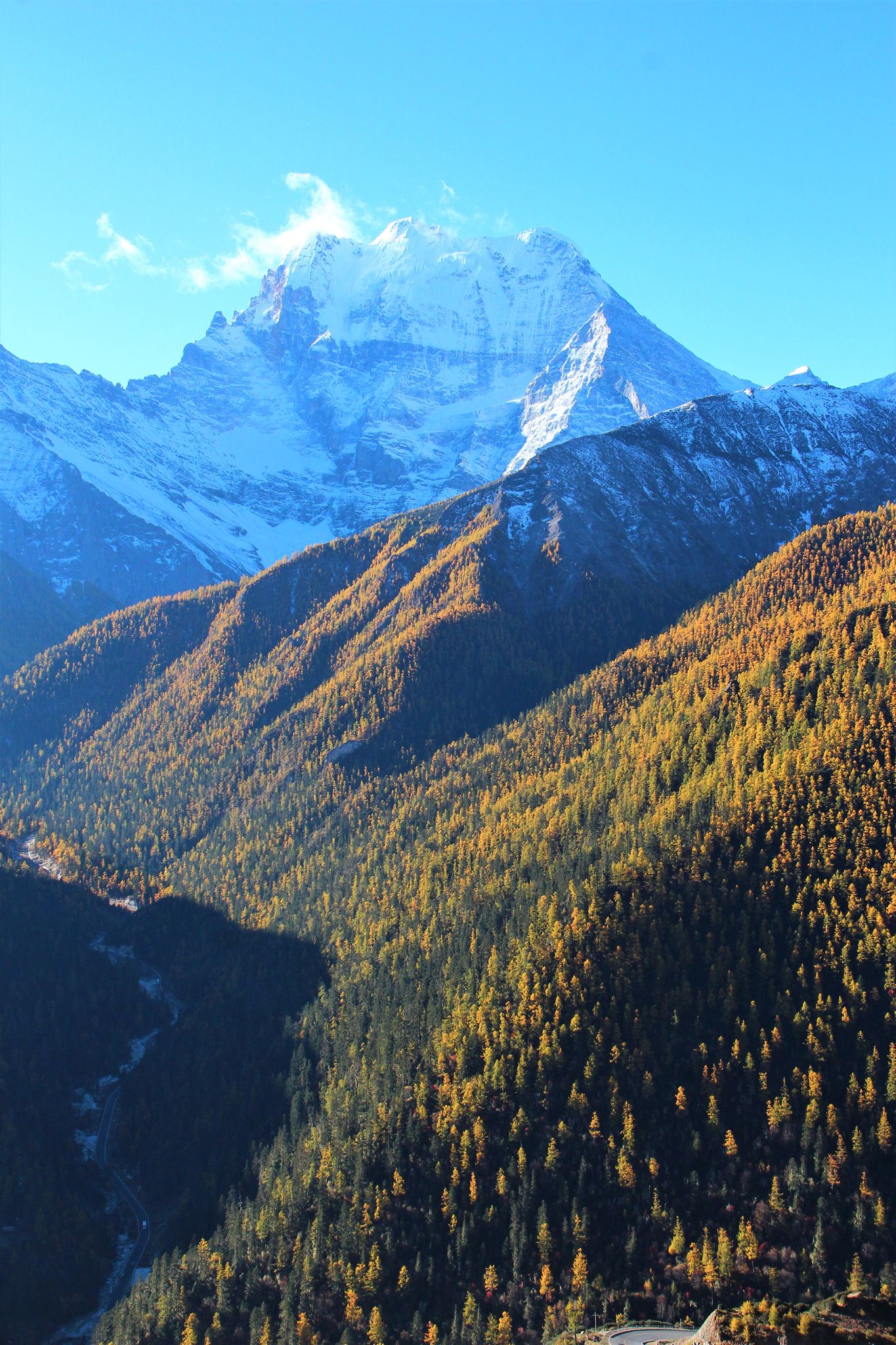
The Minya Konka (贡嘎山), at 7556 m, is the highest peak in Sichuan, and the 11th highest in the World. A good location to view the peak is Yaha Pass, about 40+ km from Xinduqiao.
Gaoersi Point (高尔寺)
First we passed some villages, then through some uninhabited tough terrain to reach the Gaoersi point at 4412 m, which is a sacred location with prayer flags and mani stones.


Yalonggou (亚拢沟)
We continued with difficult terrain to reach a calcified stream-bed known as Yalonggou
(亚拢沟), 6.5 km long and as wide as 200 m, the largest calcified stream in Asia.


Yaha Pass
The elevation of Yaha Pass is 4,568 m. The pointed peak on the right in the photos is the majestic Minya Konka, about 20+ km away. In the Tibetan language the name means "the white snow peak". It is one of the most difficult peaks in the World to climb. There are less than 30 recorded successful climbs but over 30 fatalities, half of them foreigners.


At the pass is a low peak, about 100+ m higher than the pass itself. Some tourists, including 3 in our group did trek up to the top for a panoramic view. Cold and windy, we did not go up.

A10:Xinduqiao to Litang (理塘)
After the diversion to Yaha Pass, we went west for about 210 km to Litang, a town with 70,000 people, 95% Tibetans. The elevation is about 4,200 m and it is the highest place on this trip where we stayed overnight.


Now time for another short diversion on the Tibetan culture.
B3: Tibetan Culture: Sky Burial
The Tibetans have 5 burial methods. One of them is the sky burial. The corpse is left on the mountain for vultures (or other animals) to consume. To ensure the full consumption of every part of the body, including the bones, a priest is always present to help crash the bones, and of course to perform the religious ritual too.
In Buddhism teaching benevolence/charity (布施) is a virtue. After one dies the spirit/soul would exit the body to be reincarnated in another circle of life. The corpse is nothing more than an empty vessel. It is greatlybenevolent to donate it away, like to feed the animals to sustain life.
Another method is water burial where the corpse is left in the water to be consumed by fishes. We have 2 Tibetan drivers with us on the trip and we always take meals together. And we have never ordered a fish dish. Of course they won't eat fish.
A11: Litang (理塘)
We took the opportunity to witness the sky burial here. It was early morning on a hillside. In essence the priest first cuts off the limbs and slices off the meat of other parts of the body. The vultures will finish off the meat. Then the priest crushes the bones, mixes them with flour and makes balls from them. He uses the balls to soak up blood left on the ground. The vultures will finish the balls and the burial is completed. Of course it involves performing many religious rituals.
We were there when the slicing of meat from the body was near completion. Photography of course not permitted. I shot a few from may be 100 m away with digital zoom. So photo quality is not good. In the 2nd photo people on the left are tourists, those on the right are the priest and the family of the diseased. We witnessed the proceeding some 4 or 5 m away. "We" here means 2 tourists (including yours truly) in our group and our Malaysian tour guide. The other 3 in our group stayed about 200 m away, including my wife. The 10+ witnessing crowd include other tourists not in our group.


A12: Litang to Daocheng (稻城)
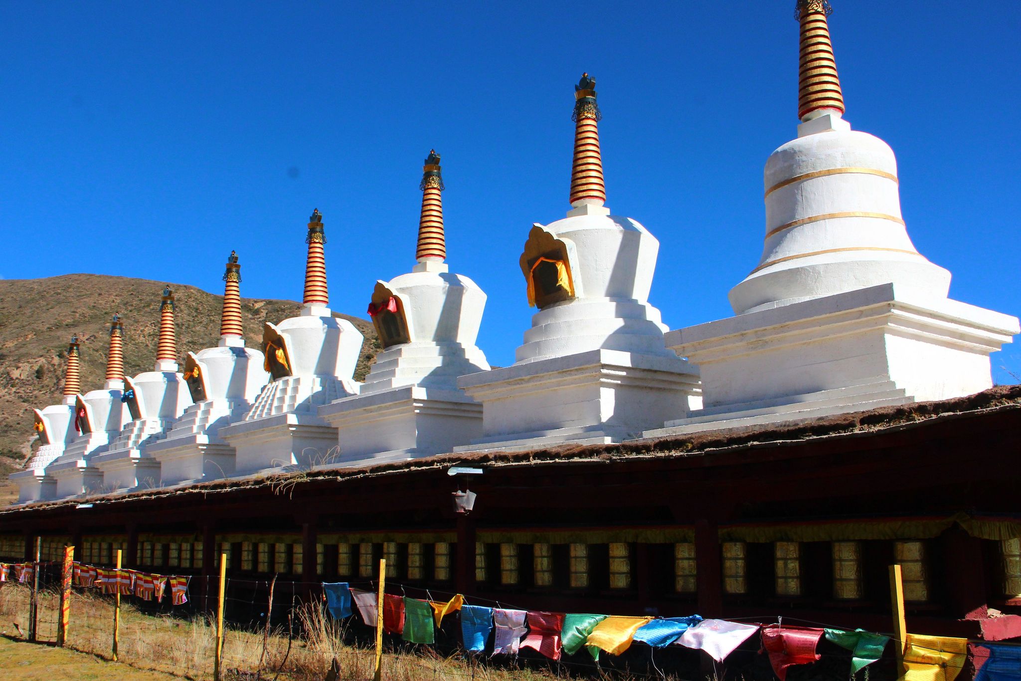
Next we went south to Daocheng, some 150 km away. The journey was very scenic, with significantly different types of landscape and vegetation. The landscape is punctuated with stupas and temples. Daocheng has some 35,000 people, more than 95% Tibetans.
The first part of the journey to Tuershan (兔儿山)


Tuershan (兔儿山)
Tuershan is a rocky observation point somewhere mid journey


From Tuershan (兔儿山) to Daocheng (稻城)
More of the same.


Wandui’s house
We are a party of 6 (initially 7), including our Malaysian tour leader. And we travelled in two 4-wheel drives, Mitsubishi Pajero. One of the drivers is the young Wandui. We visited his father’s house near Daocheng. A big house, neighbours helping out in the compound to sieve the grains of "qingke" (青稞) a Tibetan barley, spacious first floor and a piece of pork belly hanging out to dry near the door on the first floor. A place for Old Mao and 2 youngsters.


Now another diversion to ask ourselves: where is this Shangri La we are looking for? We are nearing our last stop.
B4: Where is Shangri La?
In the 1920s, an American explorer/photographer, Dr Joseph Rock travelled around the western part of Sichuan and north-eastern part of Yunnan provinces for about 2 years. He was in Yading (亚丁), last stop on our trip, for weeks. In 1931 he published his story in the National Geographic together with many photos.
In 1933 James Hilton published his famous novel "Lost Horizon". The place of "Shangri La" in the novel is said to be based on Dr Rock's account of this region.
So Shangri La is just a fictitious name, not the name of a real specific place. For tourism promotion purposes many places in this vast region have claimed to be the real Shangri La. In Yunnan a city previously called Zhongdian (中甸) changed its name to Shangri La in 2002. Also in 2002 a village named Riwa (日瓦) near Yading in Sichuan also changed its name to Shangri La Village, and became Shangri La Town in 2009.
A13: Yading Nature Reserve (亚丁自然保护区)
Shangri La Town is about 70 km south of Daocheng. And 35 km further south is the entrance to the Yading Nature Reserve, Sichuan's Shangri La. The reserve is huge, over 1,340 sq km. It is listed under UNESCO MAB – Biosphere Reserve, just like Jiuzhaigou, the more famous nature reserve in Sichuan.
At Shangri La Town we had to take their special bus to the park entrance at Longtongba (龙同坝). Then we have to walk for some 20 minute to reach the station for the eco-friendly park buses for access to many parts of the reserve.
Longtongba (龙同坝)
The scenery from Longtongba to the eco-bus station and around the station is refreshing, with snow-capped peaks, autumn foliage, etc.


Chonggushi (冲古寺)
We stopped by the Chonggushi, a temple built some 800 years ago but not in the best of shape.


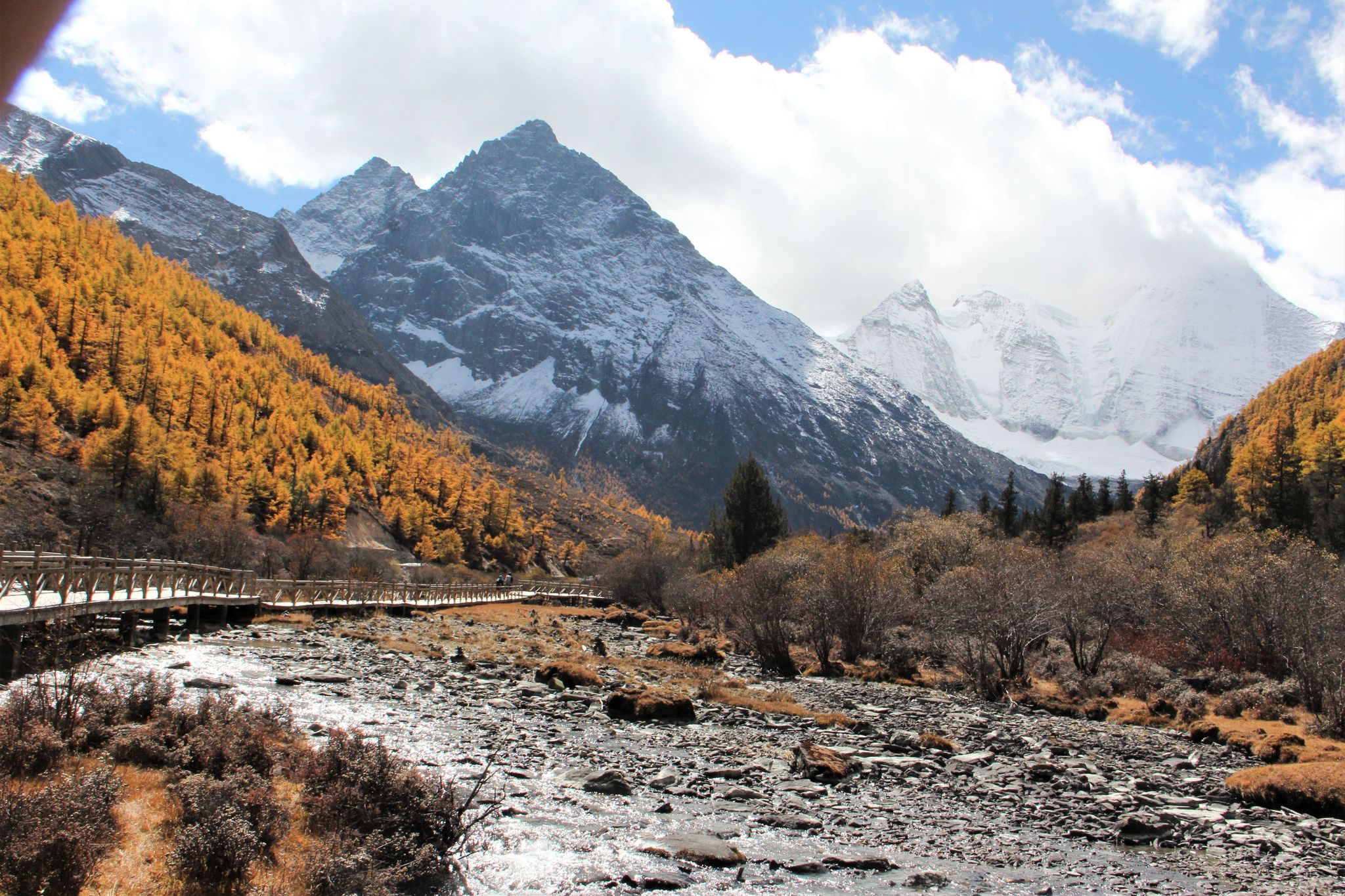
Zhenzhuhai (珍珠海)
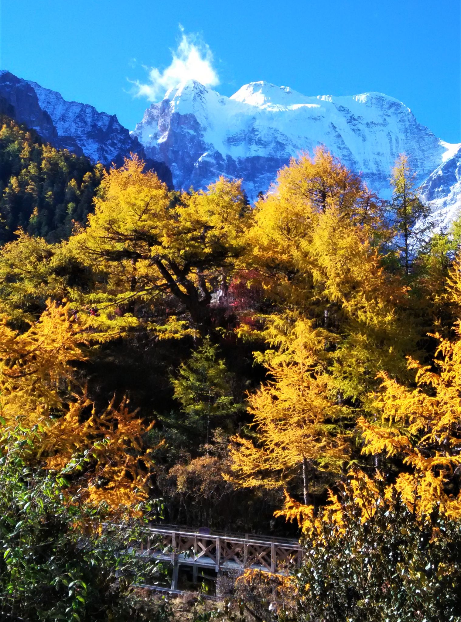
From Chonggushi we took an hour to trek up to the highland lake, Zhenzhuhai or Pearl Lake. More autumn foliage on the way.


At Zhenzhuhai, we could have a good view of Xiannairi (仙乃日), at 6,032 m, the highest of the 3 sacred peaks in the reserve. Unfortunately due to the clouds we could only have a partial view.


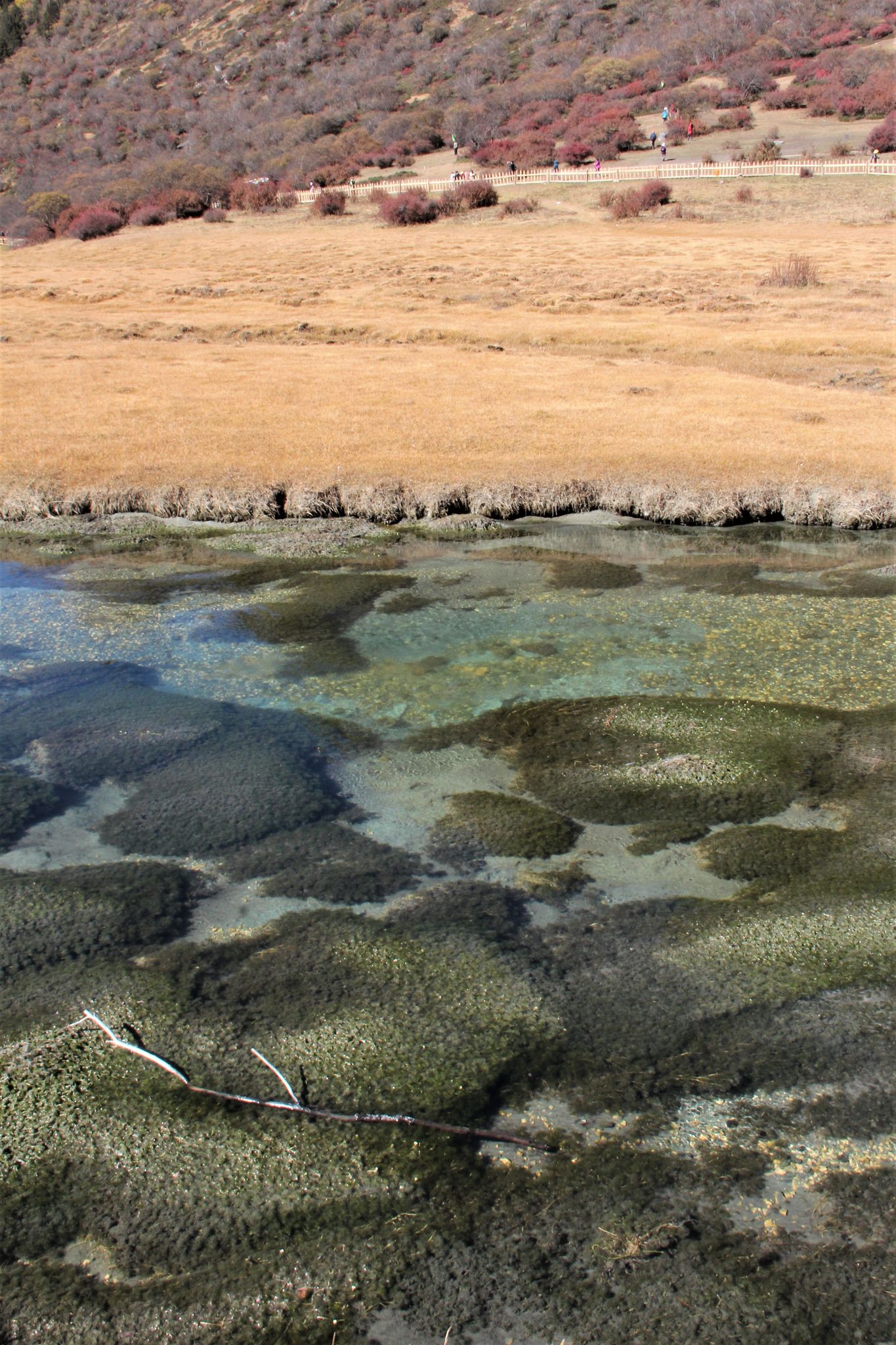
Luorong Pasture (洛绒牛场)
The most popular attraction within the reserve is Luorong Pasture, around the 4150 m level. A wide expense of grassland with streams, surrounded by snow-capped peaks, glaciers, etc. The pointed peak in the 1st photo is Yangmaiyong (央迈勇), 5,958 m, the 2nd highest of the 3 sacred peaks.

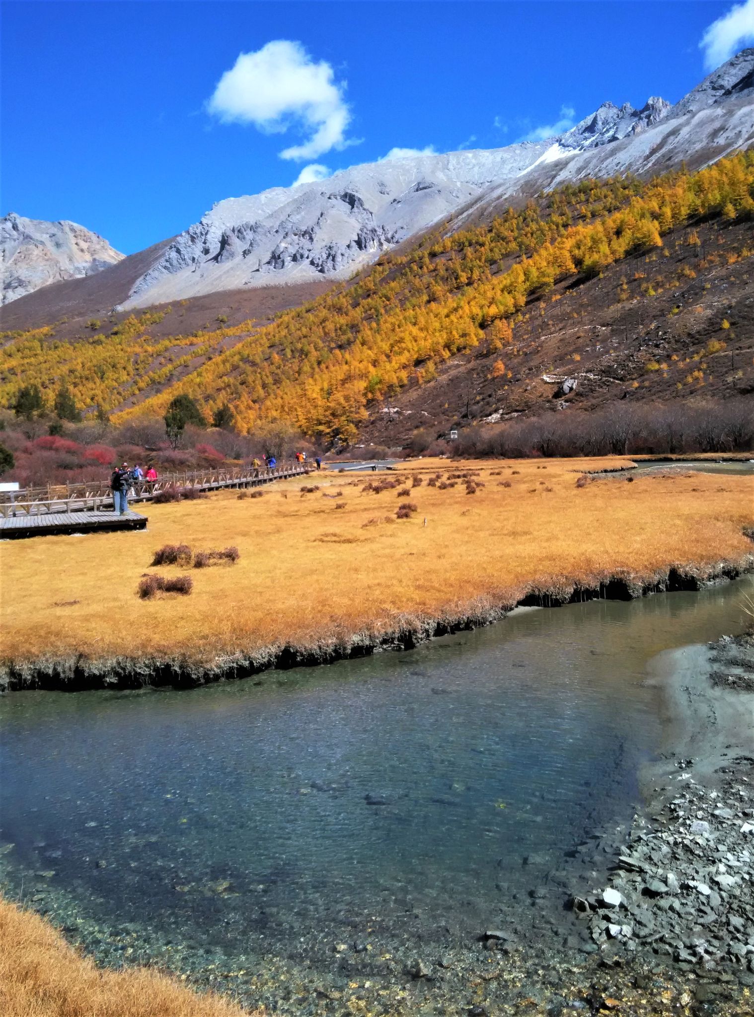


In the park we walked on mostly timber boardwalks, and occasionally some concrete steps, metal decks and tree trunks.


Have we found our Shangri La? No, but we found the scenery and autumn foliage at Yading Nature Reserve exceptionally picturesque. We were very lucky as far as weather was concerned. A sunny day. And our timing of witnessing the autumn foliage was perfect.
A 14: Back to Daocheng
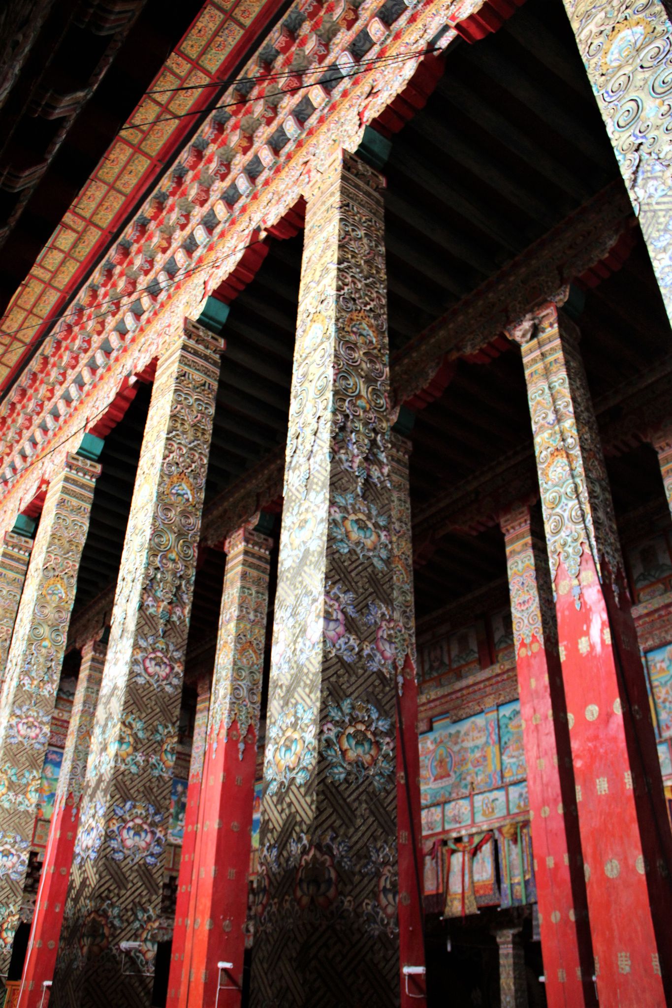
Our older driver is Luorong (洛绒), same name as the Luorong Pasture. He is in his 40s and a bachelor. During the winter months he became a part-time monk. We visited the Gonglingsi (贡岭寺), his winter monastery. It was founded in the 1170s. The present buildings were mostly re-built in the 1980s, richly decorated, after the older ones were badly damaged during the Cultural Revolution.


We also visited his sister’s house, a huge one. In fact in this village of some 40+ houses, about a third are of such size. Shown the timber staircase to go up to the flat roof. Old Mao and Deng are their gods. We were offered the traditional Tibetan “butter tea” or 酥油茶.


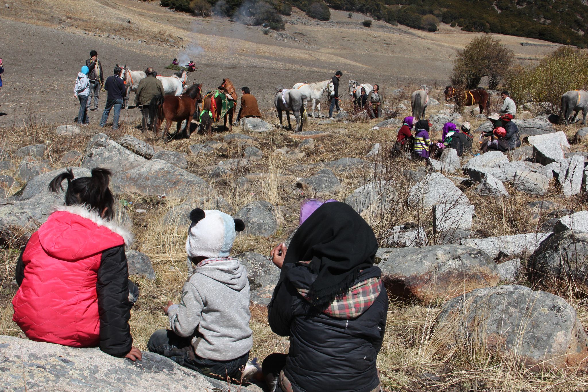
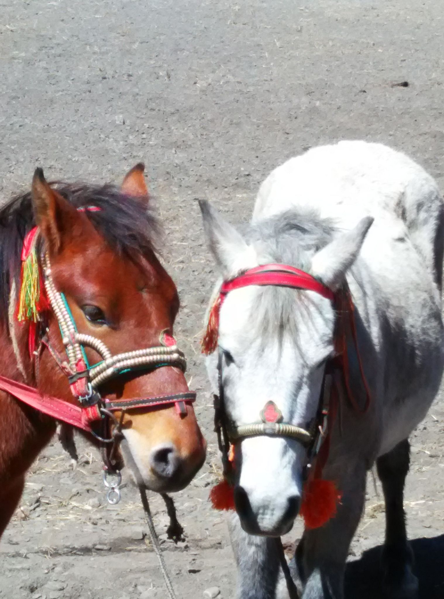
We also went back to the village of Wandui, the younger driver. We were advised that the village of 17 households was having their race day, said to be a rare bi-yearly affair. All the villagers were there, the ladies dressed up for the occasion. The praying session and chanting lasted nearly 2 hours, and the race, with 5 or 6 horses, lasted a few minutes. No winner, no prize. We could not understand the significance of the race. The 2 young priests did enjoy their photo shoots while the 2 horses talked about the weather.


A14: Chengdu (成都)
We stayed an extra day in Chengdu, the capital of Sichuan. In fact lost one day due to the flight cancellation at Daocheng. Went to Jinli (锦里), like all tourists do, and the New Century Global Center (新世纪环球中心). It is the World's largest building in terms of floor area, with shops, hotel, theme park, etc. The area for retail shopping is two and a half times that of our KLCC. Had dinner there with the main dish called “焖锅” or "dry" steamboat.


Our tour is ended. Now some footnotes.
C1: the Journey
There were supposed to be 8 of us, including our Malaysian tour leader, in two Mitsubushi Pajeros driven by Luorong and Wandui. One paying passenger could not make it the last minute, so we actually started off with 7. Then one more got sick the 2nd day and left the tour. We ended up with 4 people in each of the Pajero, including the driver. Very comfortable. Mostly on 2-lane roads, some sections unpaved. The big plus point of a small group is we could stop any place we wanted to, and change itinerary easily.
C2: Sichuan Food
Sichuan food is famous for being hot and spicy, using a lot of chilli and Sichuan pepper
(花椒). Even a plate of vege has a lot of chilli. And it suits us nicely, we eat the vege, the Tibetan drivers eat the chilli and pepper.

The “signature” dish in this region is chicken cooked with pine mushroom (松茸土鸡). There are many specialty shops selling this dish. Pine mushroom is getting very expensive as more tourists come into this region.

(Note in 2021: President Moo of South Korea met his counterpart Kim of North Korea in late September 2018. The present given by Kim to Moon is this pine mushroom, said to be 2,000 kg of the highest grade)
C3:Getting Sick
One of us, HG, fell sick on the 2nd day of the trip, with severe dehydration, etc. He was hospitalised on the 3rd day, and had to leave the tour. He stayed in the hospital for 3 or 4 days and upon discharge went back to Malaysia on his own.
C4: Cancelled Flight
At the end of our trip we had an internal flight from Daocheng to Chengdu on China Eastern Airlines. On that very cold morning (temperature minus 2 or 3 degrees) we rushed to the airport only to be told the flight has been cancelled and we have been put on the same flight the next day. It seems this is not uncommon. The Chinese airlines just cancel or postpone their flights as they see fit (make economic sense).
A customer is expected to check the airlines’ websites for any departure from schedule. We were caught unaware of the practice. Only in China. #*@&%k+$x.
This has affected all of us. We missed one day’s lepak in Chengdu. The worst affected was Alex, who had to reschedule his flight from Chengdu to KL and KL to KK.
C5: Acute Mountain Sickness
This sickness is the discomfort one experiences when one “suddenly” goes to a place more than 2,500 m in elevation. One might get shortness of breath, headache, nausea, loss of appetite, etc, etc.
We were in the region mostly over 3,000 m. Everyone was affected, just difference in degrees. I was the most affected: could not sleep. The oxygen content in the air is reduced by a third when one reaches an elevation of 3,000 m. We are certainly not getting enough oxygen if we don’t breathe faster. We consciously try to breathe faster and so we can’t relax enough to go to sleep. I have to rely on breathing extra oxygen stored in an oxygen “pillow”. Each refill cost around RM 35 to RM 40. Had 2 refills.

(Note in 2021: At the last hotel we stayed in Daocheng due to the cancelled flight, the hotel boss used a small gadget to measure the oxygen level in our blood for all the 6 of us. And my reading was the poorest and he said I might be suffering from this Acute Mountain Sickness. So accurate. We were quite impressed by that little gadget. This was my first encounter of the oximeter, a common household gadget during this pandemic.)
C6: the Bad and the Good
We were in a comparatively remote region in China. The question on the type and cleanliness of public toilets comes in, all my friends are asking. Yes, they still have public toilets without doors, or even partitions. Not many though, the situation is improving.

Then the good: wifi is widespread. Not only all the budget or 3-star hotels we stayed have wifi, even the small one-shop-size restaurants have wifi. The most popular passwords: 12345678 or 88888888. Yours too? Printed on the menu or pasted on the wall. Password is no secret at all.

C7: the Tour Operator
This tour is operated by Gogolion, a Malaysian outfit. Their FB page: www.facebook.com/gogolion.holidayplanner. They specialise in small group tours to less travelled places. Our tour leader is Khim. She handled the 2 unexpected incidents (cancelled flight and sick tourist) very well and professionally.
Thanks, Khim.
Thank you for reading. Happy New Year 2016.
Hon
(29-12-2015)
(First written in the email format in December 2015. Lightly revised to this PDF format in June 2021)
No comments:
Post a Comment